
Flood Preparation & Response
 EMERGENCY CONTACTS
For emergency flooding, please call Dispatch at 507-537-7000.
CURRENT RIVER LEVELS
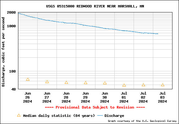
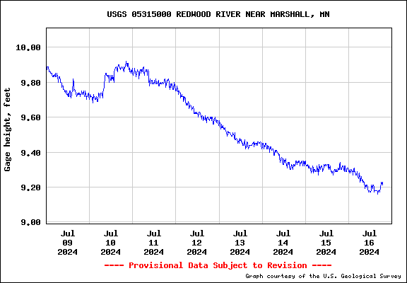
USGS has a gage with camera located nearby Wayside Park. Click Here to see the data and timelapse photos.
The National Weather Service also provides a map showing the current river levels. Click Here for more information.

SUMMARY OF FLOOD CONTROL IN MARSHALL
There are 5 earthen embankment levees that protect the City of Marshall from the Redwood River flood events.
In addition to the 5 levee segments, there is a Redwood River Diversion Channel that routes flood waters around
Marshall’s perimeter. The Redwood River is controlled by three large gate valves at the beginning of the
Diversion Channel in SW Marshall that work in coordination with a large weir wall and drop structure. There is another weir
wall ‘drop structure’ approximately 4,500-FT north of the beginning of the Diversion Channel. The purpose of this
structure is to lower the grade of the channel.
The entire flood control project, which includes engineered portions of the Redwood River, earthen embankment levees, control and
drop structures, and interior drainage ways and drainage pipes is continually monitored by City Public Works staff. City Public Works
maintenance staff are responsible for regular maintenance of the system which includes, but is not limited to: mowing, weed spraying,
rip rap maintenance, culvert/headwall cleaning, flap gate maintenance, concrete sealing, impediment removal, and operation of gate valves.
The USACE conducts regular inspections of the flood control project. City Public Works maintenance staff works in close coordination with
Engineering Department staff for work direction based upon findings from those inspections.
LEVEES
There are 5 levee segments that serve to protect the City of Marshall from Redwood River Flooding.
UNIVERSITY OF MN EXTENSION
Click Here to find out about fact sheets and videos with research-based tips on immediate and long-term flood issues.
FLOODS: PROTECTING YOUR HEALTH
A few simple precautions can help you avoid possible health risks during a flood. Click Here for more information.
MNDOT TRAVEL TIPS
For Road Closures on County and Local Roads Click Here.

EMERGENCY CONTACTSFor emergency flooding, please call Dispatch at 507-537-7000.
CURRENT RIVER LEVELS
USGS has a gage with camera located nearby Wayside Park. Click Here to see the data and timelapse photos.
The National Weather Service also provides a map showing the current river levels. Click Here for more information.
SUMMARY OF FLOOD CONTROL IN MARSHALL
There are 5 earthen embankment levees that protect the City of Marshall from the Redwood River flood events.
In addition to the 5 levee segments, there is a Redwood River Diversion Channel that routes flood waters around
Marshall’s perimeter. The Redwood River is controlled by three large gate valves at the beginning of the
Diversion Channel in SW Marshall that work in coordination with a large weir wall and drop structure. There is another weir
wall ‘drop structure’ approximately 4,500-FT north of the beginning of the Diversion Channel. The purpose of this
structure is to lower the grade of the channel.
The entire flood control project, which includes engineered portions of the Redwood River, earthen embankment levees, control and
drop structures, and interior drainage ways and drainage pipes is continually monitored by City Public Works staff. City Public Works
maintenance staff are responsible for regular maintenance of the system which includes, but is not limited to: mowing, weed spraying,
rip rap maintenance, culvert/headwall cleaning, flap gate maintenance, concrete sealing, impediment removal, and operation of gate valves.
The USACE conducts regular inspections of the flood control project. City Public Works maintenance staff works in close coordination with
Engineering Department staff for work direction based upon findings from those inspections.
LEVEES
There are 5 levee segments that serve to protect the City of Marshall from Redwood River Flooding.
- - Left Bank Upstream Segment: protects a population of 15, 9 structures, and $16.1M in property value. The segment is 0.42 miles long with a maximum height of 12.50-FT.
- - Left Bank Upstream 1963 Level Segment: protects a population of 26, 16 structures, and $20.6M in property value. This segment is 0.86 miles long with a maximum height of 9-FT.
- - Right Bank Upstream Segment: protects a population of 7,642, 1,955 structures, and $1.94B in property value. This segment is 1.6 miles long with a maximum height of 15-FT.
- - Left Bank Downstream Segment: protects a population of 84, 39 structures, and $7.77M in property value. This segment is 0.2 miles long with a maximum height of 5-FT.
- - Right Bank Downstream Segment: protects a population of 2,776, 691 structures, and $293M in property value. This segment is 2.03 miles long with a maximum height of 8-FT.
UNIVERSITY OF MN EXTENSION
Click Here to find out about fact sheets and videos with research-based tips on immediate and long-term flood issues.
FLOODS: PROTECTING YOUR HEALTH
A few simple precautions can help you avoid possible health risks during a flood. Click Here for more information.
MNDOT TRAVEL TIPS
For Road Closures on County and Local Roads Click Here.
Document Center
The Document Center provides easy access to public documents. Click on one of the categories below to see related documents or use the search function.